Exploring GIS: The Tool Mapping the World Around Us
Though GIS may sound like a technical term, it is actually intrinsic to the way many people conduct their lives. For example, when you decide you want to visit a new place, one of the first things you might do is plug in the address to Google Maps. You might not think about it at the time, but this is one of the most ubiquitous uses of GIS, or Geographic Information Systems.
But this is not the only impact it has on our daily lives. As you drive down the street, you see some new construction on the side of the road. A truck drives past with numerous goods waiting to be distributed. Telecom networks put up new infrastructure to better serve a community, working on laying down fiber in your area. All of these vital tasks are performed through and assisted by GIS. Your bank, your taxes—even the pest control specialist you see identifying an infestation uses GIS technology and data to assist with their jobs. It is an intrinsic part of the world we live in, even if many of us don’t stop to see it.
At Summit, we use GIS for numerous purposes across multiple departments. From gathering spatial data to tracking land use statistics, GIS is integral to the way we approach infrastructure. Curious about what GIS does? Check out the specifics below!
What is GIS?
GIS stands for Geographic Information System. It’s a tool that is used primarily for managing, displaying, tracking, and analyzing map data. GIS helps to highlight patterns, provides a foundation for visual mapping, improves our understanding of geological context, and makes the relationships between different points of data throughout a region more apparent. Though we make good use of it at Summit, GIS is an integral tool for problem–solving and decision-making in nearly every industry. Civil planning, healthcare, transportation, utilities, telecommunications, logistics, real estate—the jobs that make use of GIS might surprise you! Even banking, retail, and advertising are able to make extensive use of the data collected through GIS.
Some other applications of GIS include:
- Tracking inventory shipments through a region to improve the efficiency of supply chains and end-product delivery.
- Collecting data on local ecosystems or habitats to better understand how they function and help draft and execute conservation plans.
- Determine environmental or socioeconomic risk factors in an area before performing construction or purchasing land.
- To determine the volume of potential customers before building a branch location.
- And many, many more!
At Summit, we use GIS for various purposes, from planning to maintenance management. The ability to track numerous assets and store that data in one place is critical for keeping tasks on track and organized. Perhaps one of the most important aspects of GIS is the excellent ability to visualize data in a spatial environment.
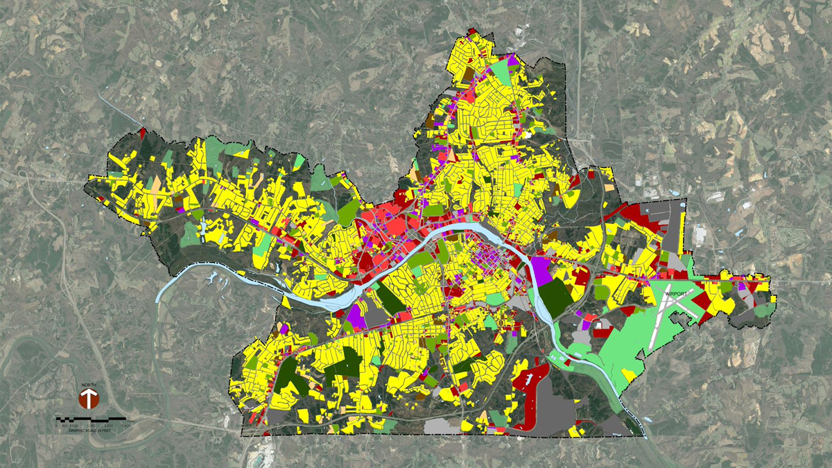
But what does GIS do? Let us simplify.
Let’s say you have a list of data about a city. For our example, we will say we have the name, the grade levels taught, the number of students, and the address of every school in Raleigh, North Carolina.
The address of the school is the “spatial data,” or data that references a specific geological area or location. Because the schools in this study are in a fixed location within Raleigh, their location is considered spatial data.
Next is “attribute data,” or data that can be used to describe or quantify a subject. For this specific study, attribute data would include each school’s name, the grades taught, and the number of students that attend.
Now that we have some basics about GIS, we will get some real-world examples of how Summit’s Planning and Maintenance Management teams use GIS data to provide our clients with high-quality work products to shape the communities we serve.
How Summit uses GIS
A tool like GIS is only as good as the data behind the tool. Our team of experts, such as Anne D. and Britt M. know and understand the data components needed to build the maps to answer the right questions to inform the decision-making process.
Here are some examples of how GIS data can map the following:
- Where Things Are
- Quantities
- Densities
- What is Happening – Think of areas that routinely experience floods during large rain events or segments road where lots of crashes happen – we can learn about what features or “attributes” are in located in that area.
- What’s Changing
Planning Team
From Anne D. – Planning Department Manager.
GIS has many applications and is widely used in the planning sphere. It allows us to create maps that display current land use, infrastructure, planned improvements, zoning regulations, and other information relevant to our industry. Moreover, we can utilize GIS to show demographic data and combine it with physical or programmatic features. For instance, we can overlay bike lanes or bus routes with the number of households that do not have access to a personal vehicle. This gives us a broader picture of the transportation needs within a town or city, which we can then use to inform our planning documents and municipal policy decisions.
It’s our goal and our duty to use maps to display data in ways that are accessible, clear, useful, and advance peoples’ understanding of the place they live. Arming individuals with the knowledge they needs to better understand their homes and surroundings allows them to remain informed about the state of their community, which enhances public participation and engagement.
But the way GIS stands out to planners– and the reason Anne D., our Planning department manager, encourages her team to learn the program and use it daily– is that GIS can be used as a thinking tool. Most map files that are produced are not suitable for publication or printing. Nevertheless, they can be used by planners to gain a better understanding of the area they are working on. By carefully analyzing a GIS file and comparing it to existing land use, environmental features, current zoning laws, and previous future land use maps, planners can make specific and targeted recommendations to better utilize the available land in service to their communities.
The subject of GIS marks a generational shift in technological utilization for planning and has been the subject of much discussion within the planning industry. Once upon a time, planners partnered with GIS technicians who made maps for them. Maps were discrete end products used for display, even for the planner who used them. Today, planners who use GIS as part of their toolbox are able to better understand the locale they are working with. This enables them to make better, detailed, and more realistic recommendations to guide communities toward a better future.
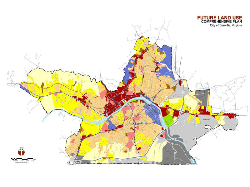
Danville Comprehensive Plan
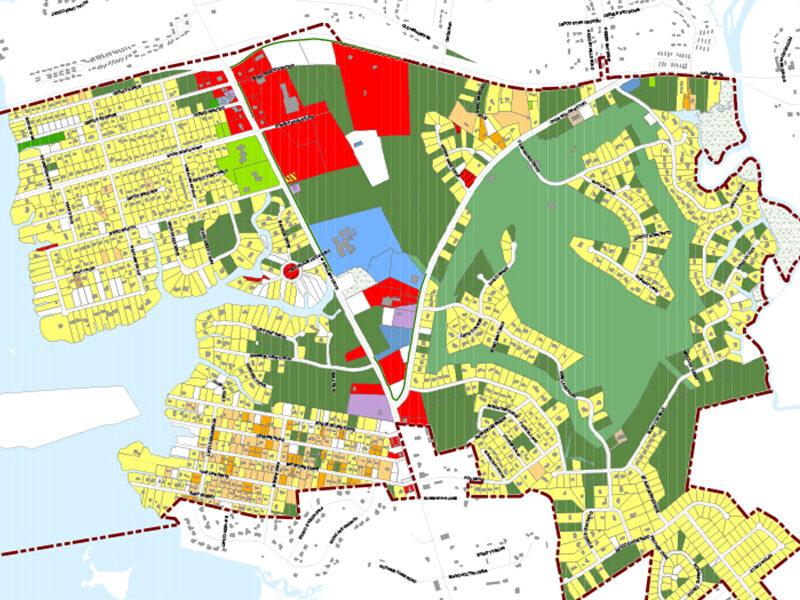
Cape Carteret Comprehensive Plan and Zoning Ordinance Update
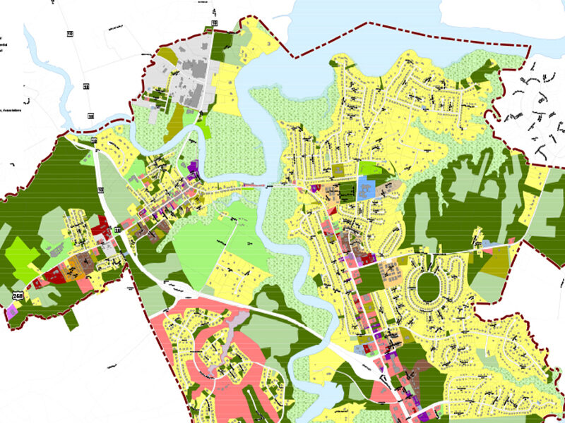
Smithfield Comprehensive Plan and Zoning Ordinance Update
Maintenance Management Team
Regarding utilizing GIS, Summit’s Maintenance Management department uses the 5 W’s– who, when, what, where, and why– to support our clients. This list includes NCDOT, municipal entities across multiple states, infrastructure construction, and private industry clientele.
Currently, our staff assists NCDOT by using GIS to track and report guardrail damage locations and road maintenance in the Triangle area and mountains of North Carolina. In this application of GIS technology, the five W’s are as follows:
- The “who” is the client or the public reporting
- the “when” is the date and time of an incident or repair
- the “what” is what was damaged, repaired, or maintained
- the “where” is the location of the site, which may be in latitude and longitude, or addressing, etc.,
- the “why” is how the event occurred or the reason for maintenance.
All this information is stored in a central location in the GIS system and can be shared across multiple platforms. Utilizing GIS data in this way helps to improve road safety measures and optimizes maintenance/repair times.
Other GIS projects we have performed include mapping municipal road networks, sewer/septic systems, response to snow and hurricane events, and a 500kV transmission line that will bring affordable energy to the customers it serves. Overall, our aim to provide a safer, more efficient, and organized environment with the benefits of GIS to help customers and the public make better-informed decisions.
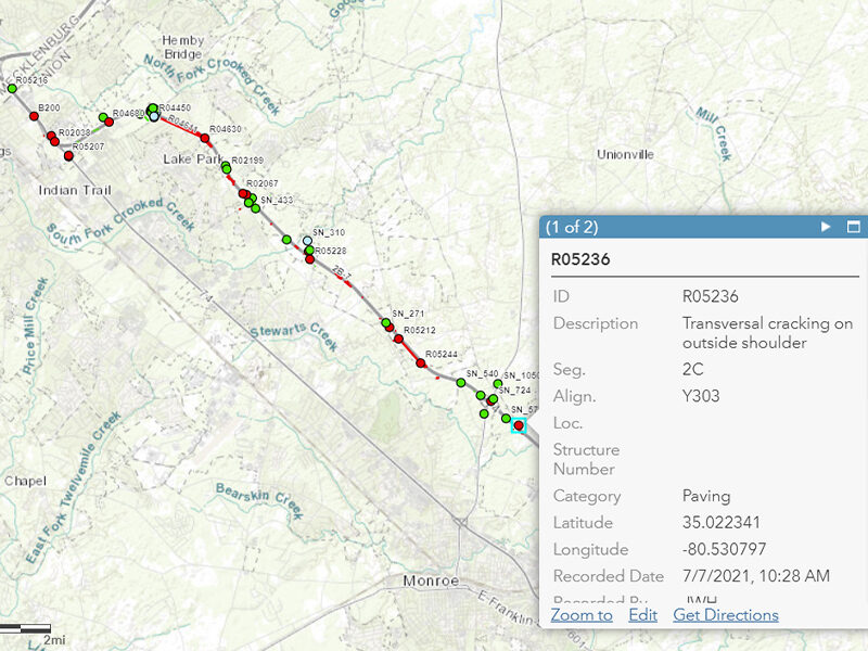
NCDOT Monroe Expressway
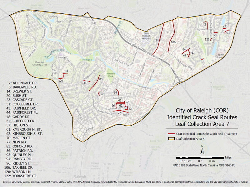
City of Raleigh Pavement Preservation
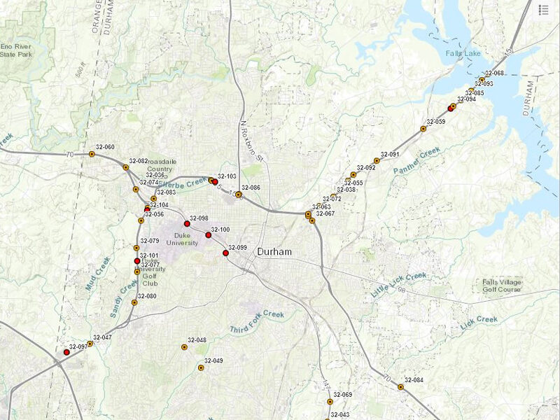
NCDOT Guardrail Inspection and Repair
What’s next for GIS?
GIS technology has become a solution-based software program with nearly-endless mapping and data collection possibilities. GIS software is flexible and robust, allowing for extremely creative means of identifying and solving problems rooted in spatial data.
One potential application that our planning team is looking at engaging in is Scenario Planning.
Scenario planning, while not unknown or brand-new in the industry, is still an emergent application of GIS capabilities. The principle is simple: by using GIS to create a “digital twin” of a mapped location, different “scenarios” can be run to see a simulated version of the locale.
This can be used to plan, predict, and account for things like population growth. Different development patterns can be rendered in real-time and analyzed to determine the best approach for these hypothetical scenarios, allowing planners to make informed decisions based on the projected needs of the municipality under these “change conditions.”
Conclusion
Geographic Information Systems (GIS) and its associated tools have revolutionized the way we analyze, interpret and visualize spatial data. GIS technology enables us to create visually appealing maps that help us better understand the world around us.
However, the real power of GIS lies in its ability to provide valuable insights into complex problems. GIS can be utilized as a decision-making tool to analyze data, identify patterns, and reveal hidden relationships. As a result, GIS is an invaluable asset that we rely on to serve our clients’ needs.
At Summit, we believe in using technology to shape communities. We understand that GIS is a key tool to achieving this goal, and we integrate it into our workflow to provide richer insights and better outcomes for our clients. By leveraging GIS, we can identify critical areas that require attention and design effective solutions that help improve the quality of life of the communities we serve.
