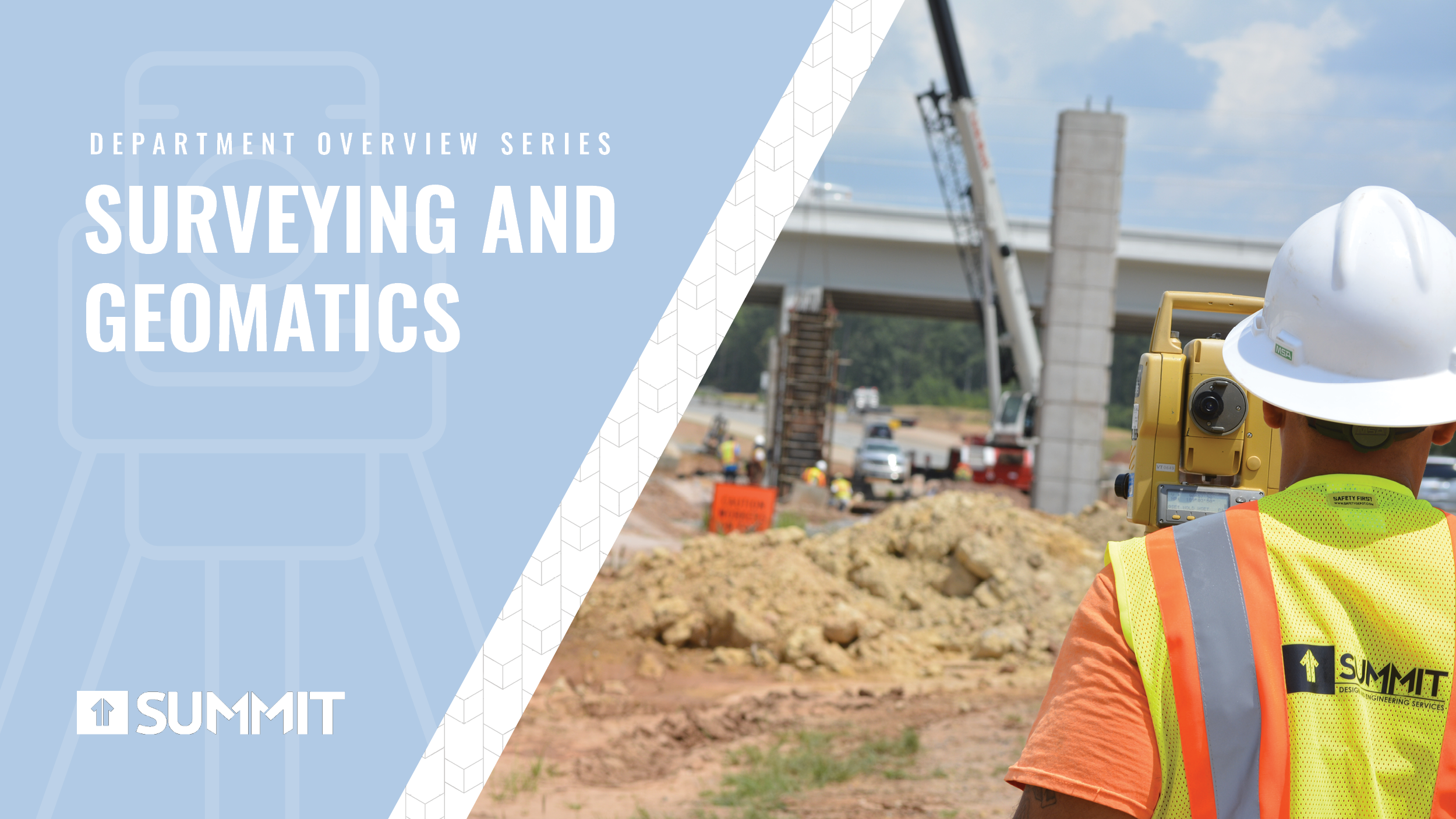
Summit’s history and Surveying as a service go hand in hand—after all, it was the service our firm was founded on. But what do you actually know about surveying and geomatics? Though they both define a long-standing profession, there are many who still don’t know the purpose—or value! —that this well-respected profession brings to the industry.
In fact, surveying is one of the oldest professions out there. Thought to have originated in Egypt, some of the techniques and tools we use today are derived from tools and methods used in antiquity, with records of land use and farm boundaries dating back to 3000 BCE! A few of our most famous US Presidents were land surveyors as well—Thomas Jefferson, George Washington, and Abraham Lincoln can all be said to have worked in the field at some point in their life. Surveying work is an important part of collective human history, and integral to the development of infrastructure as we know it.
That’s not to say, of course, that surveying work hasn’t gone through any changes in the millennia since it was first put into practice. Modern surveying and geomatics involve many new tools and methodologies. In this month’s Summit Insights, we bring you a behind-the-scenes look at Summit’s own Surveying and Geomatics department—including the tools we use and the services we provide.
Surveying is at the heart of Summit Design and Engineering Services’ very foundation. In fact, our firm got its start when current CEO Jim Parker founded it alongside professional land surveyor Alois Callemyn in 1997. At the time, it went under the name Callemyn-Parker; in 2004, the firm transitioned into the Summit Design and Engineering Services we know today.
Summit now employs an expert staff of over twenty surveyors, which includes four North Carolina-licensed Professional Land Surveyors. Our entire Surveying and Geomatics team is trained to operate the state-of-the-art equipment we have for use in the field. The surveying work we do today is still an important piece of the pie that makes up our service selection, and our team is dedicated to continuing this historic tradition in a modern age.
What is Surveying and Geomatics?
Because of surveying’s long history and its often-understated importance to the development of human environments, it can be difficult to capture the sheer scope of work in one definition.
Perhaps that is why the Encyclopedia Britannica defines Surveying as such: “a means of making relatively large-scale, accurate measurements of the Earth’s surfaces.” In practical terms, that means that surveyors utilize applied mathematics to create boundary lines, determine the contours of the earth, and measure terrain, among other things. These skills allow for the creation of maps and the establishment of landmarks, boundaries, and other points by which we navigate our world and determine its borders. Surveying is a verb—the act of producing surveys.
Geomatics, on the other hand, is a much more modern term defined (though not in brief) by the International Organization for Standardization (ISO) as a “discipline concerned with the collection, distribution, storage, analysis, processing, [and] presentation of geographic information.” Geomatics is a relatively recent designation, having been coined somewhere in the late 1960’s by scientist Bernard Dubuisson, and its general purpose is to create an umbrella term for work that Surveying falls under. While the two designations are often used interchangeably, they are technically different.

Surveying Services
Surveying isn’t just drawing maps and establishing borders. A modern surveyor is responsible for a wide range of tasks in the field, including ensuring that the project space is properly denoted using staking. By diversifying the services our surveyors can provide, like those discussed below, Summit ensures that we can satisfy a broad range of client needs.
As-Built Survey
As-Built Surveys are an important kind of survey used to determine how a structure is or was constructed versus the original and/or document design plans.
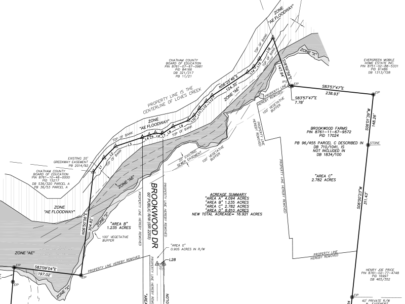
Boundary Survey
A boundary survey is a survey that retraces and marks the legal boundaries of a property or piece of land. This type of survey is usually requested by the property owner to determine the exact borders of their property. Boundary surveys also identify encumbrances or encroachments on the property at the time of the survey, and denote any potential improvements that may be made. This type of survey is often undertaken for due diligence and can be used to determine whether a parcel of land is worth buying or developing.
Existing Conditions Survey
Existing Conditions Surveys provide land developers with property boundary, topographic, utilities, environmental, and other types of information for a project site. These data types provide the base information that is used by engineers and architects to prepare design concepts and development plans.
Construction Survey
Construction staking is a service that we often provide in our hometown of Hillsborough. It requires the surveyor to interpret the construction plans, in order to compute the location of points that must be marked in the field (“staked”) with accompanying instructions on the stake, for use during construction activities. Construction surveys provide the layouts for the main elements in civil construction plans, including roads, bridges, buildings, and utilities infrastructure.
Topographic Survey
Topographic surveys are a well-known kind of land survey that determines both the natural and man-made features present on a piece of property. This can include buildings, fences, natural inclines or elevations, trees, streams, and the natural contours of the land. Elevation maps are inherently topographical in nature. The focus of a topographic survey is to provide a functional depiction of the geospatial features that are present on a property.

Route Survey
“Route Survey” is a general term that is used to describe a survey of a feature that follows a route, such as power transmission lines, gas pipelines, and roads and highways.
Hydrographic Survey
Hydrographic surveying is the task of mapping the bottom of bodies of water, such as lakes and oceans. The bathymetric portion of a hydrographic survey is accomplished by using modern tools, such as SONAR and bathymetric LiDAR to measure the bed of the water body. The hydrographic surveys that Summit performs are in shallow bodies of water; surveys of deeper bodies of water, known as “benthic” surveys, are mostly oceanographic by nature.
Geodetic Survey
A geodetic survey considers the shape, size, and curvature of the Earth’s surface to determine precise locations for spatial data that is tied to the geodetic reference frame. The geodetic reference frame usually consists of an ellipsoid-based horizontal datum and a vertical datum that is based on models of mean sea level and the Earth’s gravity field. The locations of geodetic control marks (passive stations) and continuously operating reference stations (active stations) are used in conjunction with total station and GNSS (Global Navigation Satellite System) surveying techniques to conduct surveys within the spatial reference frame. Geodetic surveying techniques are most often applied when the areas or distances a project may cover are very large and thus cannot be obtained by traditional plane surveying.
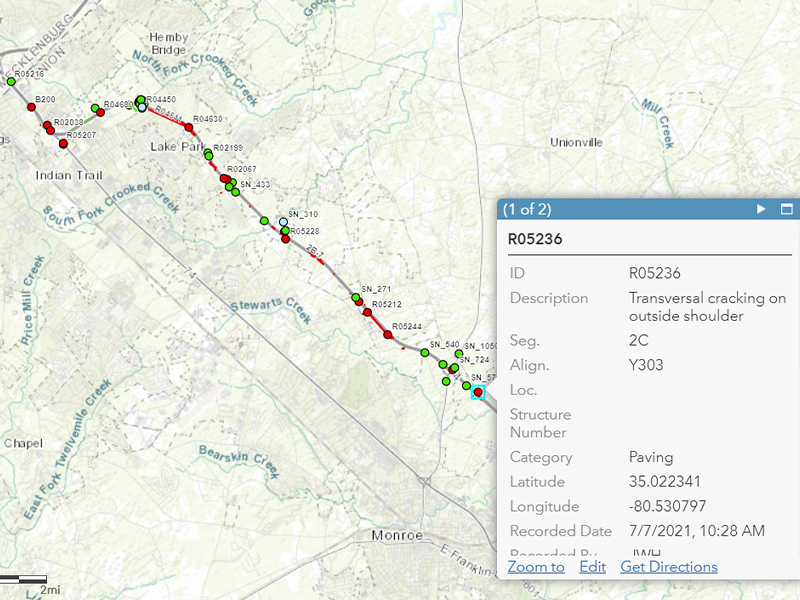
GIS Mapping and Modeling
GIS stands for Geographic Information System. True to its name, it is a system that creates, manages, analyzes, and displays data related to positions on the earth’s surface—usually in the form of maps. Generally, a GIS system has the ability to shows many kinds of ‘data’ on a map, such as where streets lay, what buildings are nearby, whether there are any bodies of water, and the level of vegetation. These can all be combined to model a locations layout, which facilitates location analysis. GIS Mapping can also be used to track movement and conduct feasibility studies. Practically, these technologies can be used to examine natural hazards, such as water retention and soil erosion; they can also be used to assist engineers in designing infrastructure or locating sections of existing infrastructure that need repair, such as tunnels or sewer systems.
And More
Surveying is a broad field with many applications, many of which intersect with Summit’s other engineering and design services. In brief, we often perform the following tasks in conjunction with other departments:

Tools of the Trade
Surveyors use a variety of modern tools to perform their duties, including optical instruments, robotic equipment, laser scanning, Computer Aided Design (CAD) software, drones, and GPS. As technology marches on, robotic equipment has been found to be more efficient than optical, human-manned instruments, which has greatly impacted the labor that goes into surveying work. In fact, using modern tools, the average surveyor can perform the same services and tasks that would once require a field crew consisting of four surveyors!
So what are the most common tools that you’ll find our surveyors using?
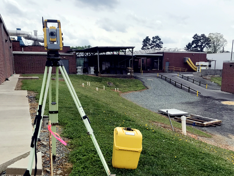
Optical Instruments
The optical instruments we use most include the Nikon NPL322+ Total Station, the Trimble DiNi Digital Level, the Leica NA720 Automatic Level and the Topcon AT-G6 Automatic Level. These tools help us to get a visual understanding of the layout of sites, both active and potential.
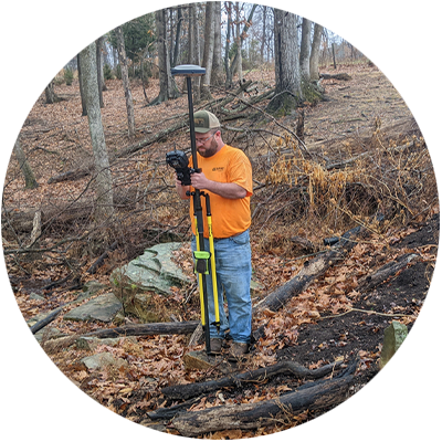
GNSS Receivers & Data Collectors
A Global Navigation Satellite System (GNSS) receiver is an essential surveying tool. It most often helps with determining the boundary, form, and positions of objects and points on earth relative to other points. GNSS receivers acquire geodetic information and data, which is relevant to conducting all manners of surveys, including large topographical surveys. The positional data we receive from GNSS gives us centimeter measurements in real time.
Some of the tools we use for this purpose include:
► Spectra Precision SP80 GNSS Receiver
► Spectra Precision Ranger 3 Data Collector
Software
Our surveyors have experience with a wide range of software, which includes Autodesk Civil 3D and ReCap, Bentley MicroStation, MicroSurvey STAR*NET. Civil 3D is our program of choice, but MicroStation is a favorite among the NC Department of Transportation, so we maintain services to ensure that we can deliver data and maps in the format our clients prefer or require.
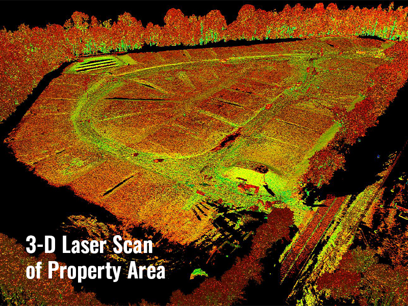
Robotic Instruments & Laser Scanner
Our robotic instruments and laser scanner technologies are extremely useful in developing 3D scans that we can then show to our clients. The laser scans produced are both fast and accurate depictions of project areas and buildings we work on. These scans can then be used as a reference to obtain accurate measurements.
These instruments include:
► Trimble S3 Robotic Total Station
► Trimble S5 Robotic Total Station
► Leica P-40 Terrestrial Laser Scanner
sUAS (Drone) Equipment
Like the laser scanning technology mentioned above, our Drone equipment is a modern tool used to rapidly gain impressive 3D models of our project sites. We use images taken from various vantage points to measure surface data, volumes of physical objects, the distance between fixed points, and more.
► DJI Mavic Air 2
► DJI Phantom 4 Pro
Conclusion
As Summit looks to the future of its Surveying and Geomatics department, we hope to continue to grow our own services alongside the growth of the field. Already we are expanding into new territories, such as Virginia, and we hope to continue to find our way into further markets, such as Tennessee.
Surveying is a very exciting field to be involved in. After all, a profession that has survived for this long is one that will continue to change and adapt to fit the needs of our infrastructure! The development of technologies and remote sensing has changed the landscape of surveying immensely, so to speak, but the work is rewarding, and the career opportunities are numerous. Construction as an industry couldn’t exist without it.
Learn More
If you would like to see some of the excellent work done recently by our Surveying and Geomatics department, check out the Discovery Charter School in Durham, NC, or check our department page to learn more.